We went to Munising, Michigan, with plans to visit Pictured Rocks National Lakeshore. Like National Parks, National Lakeshores are managed by the National Park System (NPS). According to The National Parks Foundation, the NPS oversees 423 units that fall into 20 categories like National Battlefields, Monuments, and Historical Sites. There currently are 63 National Parks, but there are only 3 National Lakeshores. The first one, Pictured Rocks National Lakeshore, was established on October 15, 1966.
After checking into a motel, we decided to explore the local area before going to Pictured Rocks. Our first stop was at Algar Falls, which sits along the side of the road on Michigan Hwy 28. Then, just a short distance down the road, we visited the Wagner Falls Scenic Site. It’s always difficult to pass up a chance to hike to a waterfall and this was a beautiful hike, only 0.2 mile each way. I also like to look for lighthouses so, continuing west from town on Michigan Hwy 28, we stopped to look at the Munising Front Range Light and the Grand Island Harbor Rear Range Light.
(Click on any photo to enlarge, then use arrows to scroll through the images.)
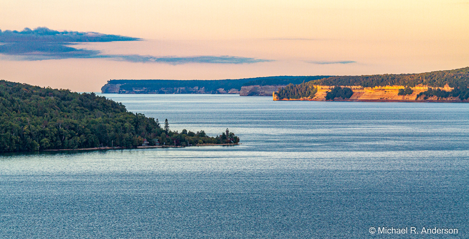
Along the highway between the two lighthouses is a great viewpoint, the Grand Island Harbor Scenic Turnout. Grand Island sits in the foreground with the Grand Island East Channel Light visible at its eastern tip. The rocky cliffs of Pictured Rocks National Seashore can be seen in the distance. It was late in the afternoon and the sun sitting low in the sky added a soft warm touch to the scene.

With a little time left before sunset, we drove into Pictured Rocks on Sand Point Road to the appropriately-named Sand Point where the Lakeshore Headquarters is located. The headquarters was closed at this time of day but we enjoyed walking on the beach, which we had to ourselves. The sun slowly setting in the west lit up the yellow flowers growing in the nearby grass.
We started the next day by driving into Pictured Rocks and stopping at an overlook for a view of Miners Castle. This is a popular spot, in part because it’s the only cliff location you can easily reach by car. And, if you like precarious places, you can even climb out onto the castle. While we enjoyed the view, a Bald Eagle soared overhead and finally landed in a tree. He must have known I had a camera because he didn’t fly or land as close as I would have liked. Leaving the uncooperative Eagle behind, we walked down a path to sunny, sandy Miners Beach. Having seen Miners Castle and Miners Beach, we thought we would go for the hat trick by driving to a trail head and hiking the 0.6-mile trail to Miners Falls.
Just outside the boundary of Pictured Rocks National Lakeshore is the trail to Tannery Falls. It’s located off of County Highway 58 across from Sand Point Road. The hike is about 0.37 miles each way and follows Tannery Creek, which adds the soothing sound of water to the experience. The water drops from a curved ledge that extends out from the rock face. This gives room for people to walk behind the falling water and experience the falls from both sides. Miners Falls had a much greater flow of water but I thought Tannery Falls was more interesting.
Heading east, County Highway 58 provides no easy access to the sandstone cliffs, so we continued driving until we reached Twelvemile Beach. This is another beach that is primarily sandy, but there’s a myriad of colorful rocks and pebbles all along the shoreline. Despite my attempts to stop it, my camera kept taking more pictures of the rocks, pebbles and sand.
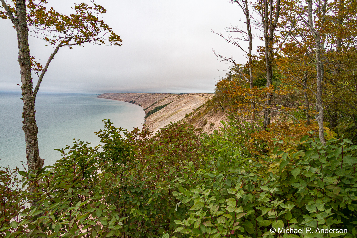
A short distance farther down the road there’s an overlook with a good view of the extensive Grand Sable Dunes. Past the dunes is the Grand Sable Visitor Center and the eastern boundary of the Lakeshore.
