As I’m sure you would expect, the shape of a National Lakeshore is long and narrow. Pictured Rocks extends 42 miles along the Lake Superior shoreline and covers 73,236 acres. Fifteen miles of this coastline consists of sandstone cliffs rising 50 to 200 feet above the lake. The cliffs are stained with colorful lines by mineral-rich water seeping from the rocks. I might have referred to these cliffs as “Painted Rocks” but, hey, someone else got there first and won the naming rights. Fortunately it’s not “Sherwin-Williams National Lakeshore” … yet.
There are no beaches from which to view the cliff faces; the only option is to see them from the water. Kayaking is a popular activity for that but we opted to reserve seats for the Sunset Cruise on the Miss Superior with Pictured Rocks Cruises, the park concessionaire. Although it was sunny the morning we made the reservations, by the time we drove into Munising in the early evening to board the boat, the clouds had started to move in. So much for the sunset part of our Sunset Cruise!
(Click on any photo to enlarge, then use arrows to scroll through the images.)
The boat pulled out of South Bay and made its way through the East Channel. We passed close by Grand Island where the interesting old East Channel Lighthouse stood watch. A wispy waterfall, probably ephemeral, trickled down the rock face of the Lakeshore. A short distance farther down the coastline the cliffs became more extensive and we recognized Miners Castle, which we had visited by land the day before. The stairs and wooden platform used to reach this formation were easy to spot.
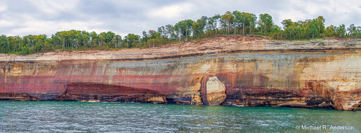
Continuing northeast along the coastline, the cliff face became less smooth and straight. Some sections were like small headlands jutting out into the lake. In some places large sections of the cliff face had sloughed off and stood leaning against the cliff with their feet in the water. Despite the apparent lack of any kind of soil, some hardy trees made their homes there. We then cruised past Bridalveil Falls, a narrow stream that flowed down the smooth outward curving wall of rock to the lake. Having already visited Bridalveil (one word) Falls in Yosemite National Park and Bridal Veil (two words) Falls in Oregon’s Columbia River Gorge, the name was not very unique. I wonder how many additional waterfalls have the same name.

As the cruise progressed, the rock formations continued to become more diverse and interesting. Soon we encountered colorful sea caves and arches as well as turrets and stone spires. As we all know, humans are prone to name things, whether they be animals, vegetables or minerals. I’m not sure if they’re inspired by the beauty in nature or the alcohol in drinks, but Pictured Rocks certainly has named features. A few of them are shown below.
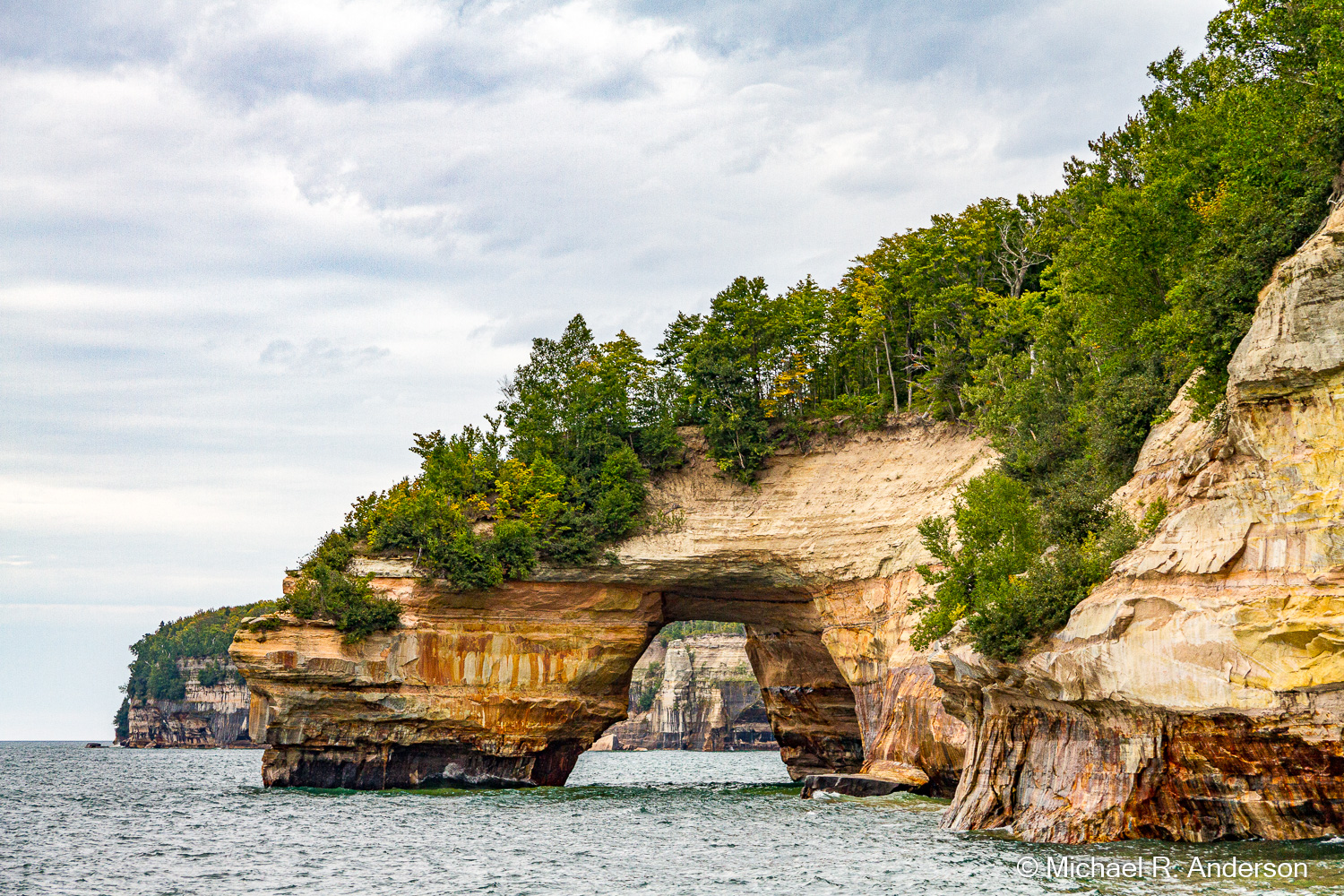
This is Lovers Leap, but I’m not sure why. I can assure you, however, that no lovers were harmed during the taking of this picture.
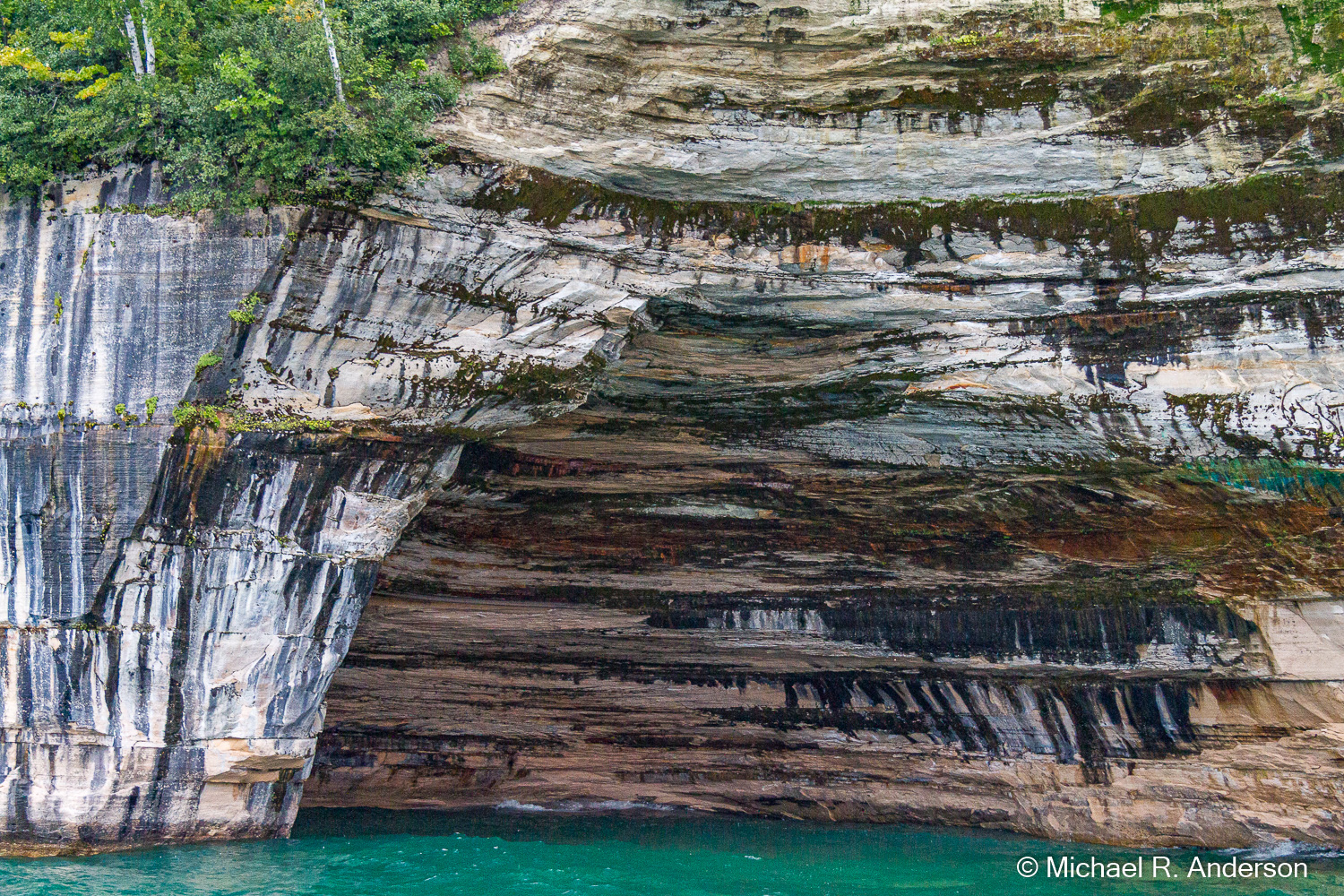
Here’s Rainbow Cave. Despite the name “rainbow” this has to be one of the least colorful rock formations in Pictured Rocks. Maybe it should have been named “Rainbow Cave in Black and White.” The lack of color didn’t bother me though, because I really like the juxtaposition of the vertical and horizontal lines.
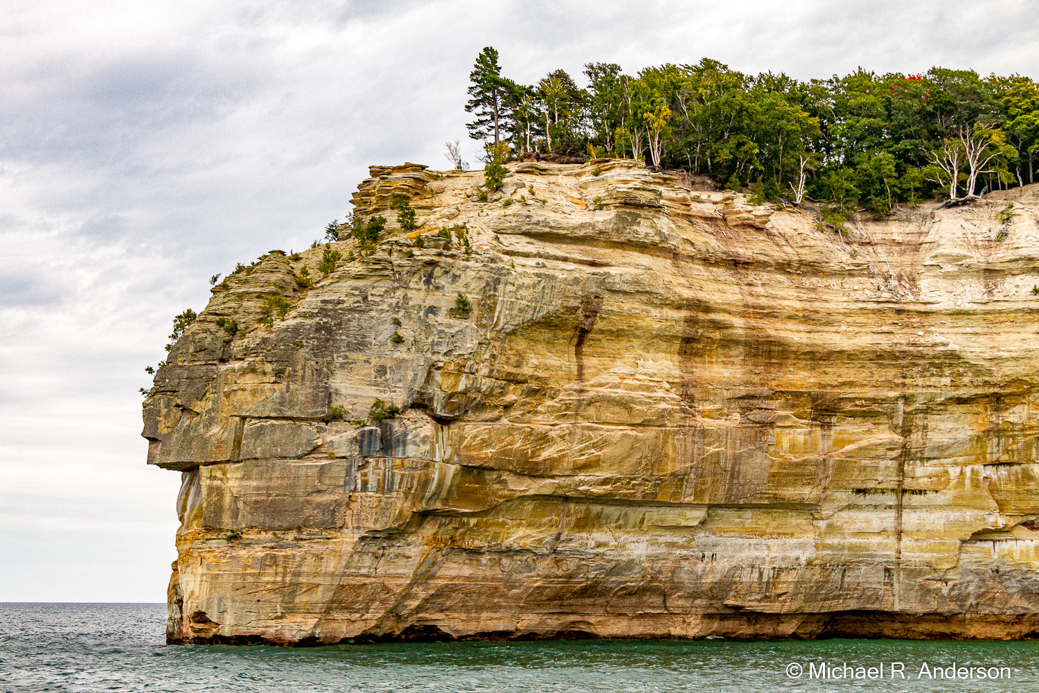
This is Indian Head. I’m not sure if using names like that is proper anymore but that’s what it was still called on the sunset cruise. There were a myriad of additional interesting formations on the last leg of the cruise. Some had names and some were nameless. I had a difficult time deciding which ones to show, so I put quite a few into the gallery below and you can decide which ones you want to see. You can enlarge any that catch your fancy.
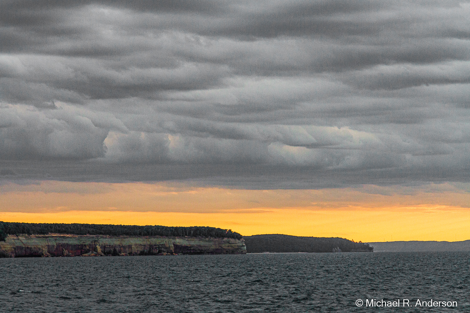
Despite the cloudy weather, as we turned and headed west back to the harbor, we did get to enjoy some color from the sunset.


Tim Mulcahy
14 Nov 2021Very nice Michael.